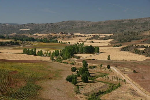
Central Kalahari Game Reserve
One of Africa's largest game reserves, site of Bushmen relocation and diamond mining.

The Central Kalahari Game Reserve is an extensive national park in the Kalahari Desert of Botswana. It is located entirely within Botswana's Ghanzi District, comprising over 40% of that district's territory.
- Rank
- Second largest game reserve in Botswana, one of the largest in Africa
Lore & Background
The Bushmen, or San, have inhabited the reserve's lands for thousands of years as nomadic hunters. Since the mid-1990s, the Botswana government has tried to relocate them, claiming they were a drain on financial resources despite tourism revenues. A nationwide ban on commercial hunting made it illegal for the Bushmen to practice their traditional hunter-gatherer lifestyle, though some subsistence hunting was allowed, while private game ranches provided hunting for tourists.
Reader's Guide
The Central Kalahari Game Reserve is significant as a vast protected area and as a site of ongoing controversy over indigenous rights. Its wildlife includes species such as South African giraffe, African bush elephant, lion, cheetah, and many others, with common trees being acacia and terminalia.
Geographic Scope and Position
The Thar Desert, also called the Great Indian Desert, sprawls across the north-western Indian subcontinent, straddling the border between India and Pakistan. Approximately two-thirds of this vast expanse falls within Indian territory, while the western portion extends into the Pakistani provinces of Sindh and Punjab. Within India, the state of Rajasthan holds the bulk of the desert, though its sandy reaches also creep into Gujarat, Haryana, and Punjab. The desert occupies about six percent of India's total geographical area. Geographically, it represents the easternmost extension of the Sahara-Arabian desert formation. Its boundaries are clearly delineated: the Indo-Gangetic Plain presses against it from the north, west, and northeast; the Rann of Kutch borders it to the south; and the Aravalli Range forms its eastern edge. To the west, the alluvial plains of the Indus River mark the desert's starting point.
Formation and Climatic History
During the Mesozoic era, the land that would become the Thar was a low-lying peneplain submerged under shallow waters. Over the post-Mesozoic and early Pleistocene periods, erosion carved three distinct layers of planation surfaces into the landscape. A pivotal shift came with the rise of the Himalayas during the mid-Miocene, which generated the monsoon system that would later shape the region's climate. This low-latitude ice reflected at least four times more solar radiation per unit area than higher-latitude ice, intensifying atmospheric cooling. The resulting loss of thermal low pressure over the subcontinent effectively silenced the monsoon, depositing vast quantities of dust toward the Arabian Sea and triggering desertification. The rapid uplift of the Aravalli Range in the early Holocene further altered hydrography, diverting waters into the Yamuna and starving the Ghaggar-Hakra system. By 4,500 to 5,000 years ago, diminished monsoons had turned the region increasingly arid, and wind-blown sand from coastal and alluvial sources began accumulating.
Topography, Climate, and Water
The terrain of the Thar is characterised by wide stretches of sand broken up by gently eroded, low-lying hills. The climate is that of a tropical desert: summers are intensely hot while winters bring cooler temperatures. Rainfall, averaging under 500 millimetres per year, arrives predominantly through the southwest monsoon, though the amounts fluctuate dramatically from one season to the next, with prolonged droughts a recurring feature. Water sources are scarce. The inland Luni River system stands as the only major river threading through the desert. To cope with the dry months, both natural depressions and man-made reservoirs are used to capture and store rainwater for later use. This combination of sandy terrain, extreme heat, and unreliable precipitation creates a landscape where water is the defining constraint on all life.
Ecology and Human Life
Despite its aridity, the Thar supports a mosaic of natural vegetation including scattered trees, thorny scrub, and patchy grasslands. A variety of animal and bird species have adapted to these harsh conditions, making the desert a surprisingly biodiverse environment. Perhaps most remarkably, the Thar stands out as one of the world's most densely inhabited deserts. The indigenous Thar people have made this landscape their home, living in small, clustered villages, with a majority following a nomadic or semi-nomadic way of life. Their economy rests on a narrow foundation: limited agriculture suited to the dry climate, the herding of livestock, and in more recent times, ecotourism that draws visitors to experience the desert's unique character. The interplay between human settlement and the fragile desert ecosystem defines the social fabric of the region, where communities navigate an environment shaped by scarce water, unpredictable rainfall, and the necessity of movement across the sand.
Frequently Asked Questions
Where exactly is the Central Kalahari Game Reserve situated?
The reserve lies entirely within Botswana's Ghanzi District, covering more than 40 percent of that district's total land area. Its position in the Kalahari Desert makes it a key dryland habitat in southern Africa.
What controversial events is the Central Kalahari Game Reserve associated with?
The reserve became internationally known for the forced relocation of the San (Bushmen) people who had lived on its lands for generations. It has also been linked to diamond mining activities that drew significant public attention.
Why is the Central Kalahari Game Reserve important to fans of deserts and drylands?
It represents one of the most extensive stretches of protected Kalahari wilderness, offering a living showcase of how flora and fauna adapt to arid conditions. Its sheer scale and ecological diversity make it a landmark site in the study of African drylands.
More in Deserts And Drylands 25-28
Elsewhere in the Deserts And Drylands universe
Spotted an error? Know more?
This is a living reference — every entry is fact-audited, and reader corrections feed straight into our audit queue. Suggest an edit · See this site's audit record