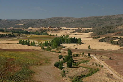
Painted Desert (Arizona)
A colorful badlands desert in the Four Corners area.

The Painted Desert is a United States desert of badlands in the Four Corners area, running from near the east end of Grand Canyon National Park and southeast into Petrified Forest National Park. It is known for its brilliant and varied colors, including red rock and shades of lavender.
- location
- Four Corners area, Arizona, USA
- width
- about 60 miles (100 km)
- climate
- cold desert climate (Köppen BWk)
- named_by
- Spanish expedition under Francisco Vázquez de Coronado
Lore & Background
He located these in western New Mexico, not east of Petrified Forest National Park. Finding the cities were not made of gold, Coronado later sent an expedition to find the Colorado River from his winter camp at Tiguex, though the route through the Painted Desert is not historically documented for that journey. Passing through the wonderland of colors, they named the area El Desierto Pintado. The desert is composed of stratified layers of siltstone, mudstone, and shale of the Triassic Chinle Formation, which erode easily. These fine-grained rock layers contain abundant iron and manganese compounds, which provide the pigments for the various colors. Thin, resistant lacustrine limestone layers and volcanic flows cap the mesas. Numerous layers of silicic volcanic ash occur in the Chinle and provide the silica for the petrified logs of the area. Much of the Painted Desert within Petrified Forest National Park is protected as Petrified Forest Wilderness, where motorized travel is limited. The desert continues north into the Navajo Nation, where off-road travel is allowed only by permit. The towns of Cameron and Tuba City, both on the Navajo Nation, are two major settlements.
Reader's Guide
The Painted Desert is significant as a striking geological and historical landmark in the American Southwest. Its brilliant colors, derived from iron and manganese compounds in the Chinle Formation, make it a unique natural wonder. The desert's badlands topography results from erosion of stratified siltstone, mudstone, and shale, and it contains fossilized remains of a Triassic coniferous forest, as well as dinosaur tracks and evidence of early human habitation. The desert spans about 7,500 square miles and experiences a cold desert climate due to the rain shadow of the Mogollon Rim. Much of the area is protected within Petrified Forest National Park, where hiking is available, while parts on Navajo Nation require permits for off-road travel. Its legacy endures as a site of scientific study, cultural history, and natural beauty, accessible via major highways and unpaved roads.
Did You Know?
- The desert's colors come from iron and manganese compounds in the Chinle Formation.
- Much of the desert within Petrified Forest National Park is protected as Petrified Forest Wilderness.
Naming and Vast Geography
The Gobi takes its name from the Mongolian word Gov', a broad term for the waterless stretches of the Mongolian Plateau. In Chinese the concept became gēbì, a word that specifically conjures rocky, semi-arid terrain rather than the rolling sand dunes most people imagine. That linguistic nuance reflects the ground truth: much of the Gobi is not sandy at all but consists of exposed, bare rock. Its greatest width sits in the west, along the line connecting Lake Bosten to the Lop Nor basin. The long axis stretches from the Pamir foothills in the west to the Greater Khingan Mountains near the Manchurian border. The Altay, Sayan, and Yablonoi ranges cap the north, while the Kunlun, Altyn-Tagh, and Qilian ranges define the southern boundary where the Tibetan Plateau begins. Some geographers separate the Tarim Basin and the Lop Nor and Hami basins as the distinct Taklamakan Desert, though conventional usage often absorbs them into the wider Gobi.
A Cold Desert of Violent Extremes
Far from the scorching heat people associate with deserts, the Gobi is fundamentally a cold one. The temperature swings are staggering. Winters can plunge to −40 °C, while summers push toward 45 °C, and a single 24-hour span can see a 35-degree shift. In southern Mongolia, readings have dipped to −32.8 °C, yet in Alxa, Inner Mongolia, July temperatures climb to 37 °C. Average winter minimums hover near −21 °C against summer maximums around 27 °C. The southeast monsoons deliver most of the summer rain to the desert's southeastern reaches, but the northern zones remain locked in cold, dry conditions driven by Siberian-Mongolian high-pressure cells. Icy dust storms and blizzards punctuate spring, early summer, and early January, making the Gobi a landscape of relentless, violent contrast.
Fossil Treasures and Hardy Wildlife
The Gobi's barren surface conceals one of the planet's richest paleontological archives. Despite the harsh environment, the desert and its fringes shelter a surprising array of animals. Endemic species include the black-tailed gazelle, the marbled polecat, the wild Bactrian camel, the Mongolian wild ass, and sandplovers. Snow leopards, Gobi bears, and wolves make occasional appearances. Lizards are particularly well adapted to the climate, with around thirty species distributed along the southern Mongolian border. Vegetation is sparse but resilient: drought-tolerant shrubs such as gray sparrow's saltwort and gray sagebrush, along with low grasses like needle grass and bridlegrass, dot the landscape. Livestock grazing has thinned these shrubs over time, prompting the creation of protected areas including Gobi Gurvansaikhan National Park and the Great Gobi A and B Strictly Protected Areas.
Encroaching Sands and the Green Great Wall
The Gobi is not a static boundary; it is a moving one. The northern and eastern desert-grassland boundaries shift constantly, influenced by pre-growing-season climate conditions that govern evapotranspiration and plant establishment. The drivers are largely human: deforestation, overgrazing, and the depletion of water resources, compounded by broader climate change. In Mongolia, nomadic herders raising goats for cashmere wool have degraded grasslands, while off-road vehicles and livestock trampling compound the damage, particularly in the wetter eastern Gobi. China has mounted a massive countermeasure. In certain locales the effort has already slowed or even reversed the desert's advance.
Frequently Asked Questions
What is the climate of the Painted Desert?
It falls under a cold desert climate (Köppen BWk), meaning it is dry year-round but experiences notably cold winters rather than the extreme summer heat found in warmer deserts.
What makes the Painted Desert visually distinctive?
The landscape is renowned for its vivid, layered coloration—deep reds, purples, and shades of lavender—produced by mineral-rich badlands formations that shift hue across the terrain.
More in Deserts And Drylands 25-28
Elsewhere in the Deserts And Drylands universe
Spotted an error? Know more?
This is a living reference — every entry is fact-audited, and reader corrections feed straight into our audit queue. Suggest an edit · See this site's audit record