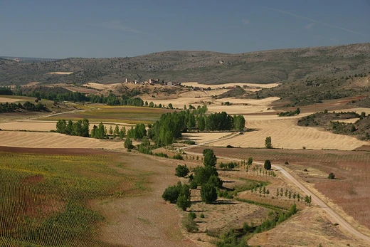
Badain Jaran Desert
A vast desert with towering stationary dunes, spring-fed lakes, and a river along its edge.

It is notable for containing some of the tallest stationary dunes on Earth, over 100 spring-fed lakes, and the singing sand phenomenon.
- location
- China (Gansu, Inner Mongolia, Ningxia, Alxa League)
Verified Timeline
Lore & Background
The desert's name is of debated origin; while sometimes interpreted as 'mysterious lakes' in Mongolian, this meaning is not definitively established. The desert features over 100 spring-fed lakes between the dunes, some fresh and some extremely saline. These lakes are not completely studied, and high pH lakes harbor interesting animal communities. This occurs only in summer when sand is dry.
Reader's Guide
The Badain Jaran Desert is significant for its unique geological and ecological features. Its stationary megadunes, some exceeding 500 meters, are among the tallest in the world and are stabilized by compacted sand layers and high moisture. The desert's numerous lakes, with varying salinity and color changes due to algae and minerals, support nomadic herding of camels, goats, and horses. The singing sand phenomenon, shared by only about 35 other locations globally, adds to its scientific interest. The desert is also a subsection of the Gobi Desert and is merging with the Tengger Desert due to desertification.
Did You Know?
- The name 'Gobi' comes from the Mongolian word Gov', meaning 'dryland,' used for all waterless regions on the Mongolian Plateau.
- In 1923, researchers uncovered the first dinosaur eggs ever found in the Gobi Desert—twenty-six eggs averaging 23 centimetres in length.
- The Gobi's temperature can swing by as much as 35 °C in a single 24-hour span.
- The Gobi Desert is expanding into China at a rate of 3,600 km² of grassland overtaken each year.
- The Three-North Shelter Forest Program, launched in 1978, aims to plant trees across 36.5 million hectares in northern China to slow desertification.
Vast Dimensions and Physical Character
The Gobi is the sixth-largest desert on Earth, a sprawling cold desert and grassland region straddling southern Mongolia and northern China. Its dimensions are staggering: roughly 1,600 kilometres from southwest to northeast and 800 kilometres from north to south, encompassing approximately 1,295,000 square kilometres. The western edge begins near the Pamir foothills at 77 degrees east, while the eastern boundary reaches the Greater Khingan Mountains around 116 to 118 degrees east, near the Manchurian border. To the north, the Altay, Sayan, and Yablonoi ranges form the ceiling; to the south, the Kunlun, Altyn-Tagh, and Qilian ranges mark the northern rim of the Tibetan Plateau. Despite its desert classification, much of the terrain is exposed bare rock rather than shifting sand. The name itself derives from the Mongolian word Gov', meaning simply 'dryland,' a term applied to all waterless stretches across the Mongolian Plateau. The Chinese borrowing, gēbì, carries a slightly narrower connotation, pointing specifically to rocky semi-desert landscapes. Some geographers and ecologists prefer to carve out the western Tarim basin and the Lop Nor and Hami desert basins as a separate entity, the Taklamakan Desert.
A Landscape of Violent Extremes
Far from the warm, sun-baked image most people associate with deserts, the Gobi is fundamentally a cold environment. Sitting on a plateau between roughly 910 and 1,520 metres above sea level, it endures frost and even snowfall on its dunes. Annual rainfall averages a meagre 194 millimetres, with most of that moisture arriving in summer. In winter, winds sweeping off the Siberian Steppes deposit additional snow across the landscape. The temperature range is almost incomprehensible: winter lows can plunge to minus 40 degrees Celsius while summer highs climb to 45 degrees. In a single 24-hour period, shifts of as much as 35 degrees are recorded. Southern Mongolia has logged a frigid minus 32.8 degrees, while Alxa in Inner Mongolia hits 37 degrees in July. The southeast monsoons manage to reach the Gobi's southeastern reaches, but the Siberian anticyclone dominates winter, locking the region into extreme dryness. Northern stretches, battered by Siberian-Mongolian high pressure cells, are so cold and arid that they support almost no plant life, and icy dust storms and snow squalls punctuate spring, early summer, and early January.
Fossil Treasures and Hardy Wildlife
The Gobi has proven to be one of the most extraordinary fossil repositories on the planet. In 1923, researchers uncovered twenty-six dinosaur eggs, each averaging about 23 centimetres in length, a discovery that marked the first dinosaur eggs ever found. The Nemegt Basin in northwestern Mongolia has since yielded early mammal remains, additional egg clutches, and prehistoric stone tools dating back roughly 100,000 years. Despite the harshness of the environment, the desert and its fringes shelter a remarkable array of animal life. Endemic species include the black-tailed gazelle, the marbled polecat, the wild Bactrian camel, the Mongolian wild ass, and sandplovers. Snow leopards, Gobi bears, and wolves make occasional forays into the area. Lizards are particularly well represented, with around thirty species distributed along the southern Mongolian border. The dominant vegetation consists of drought-tolerant shrubs such as gray sparrow's saltwort and gray sagebrush, along with low grasses like needle grass and bridlegrass. Several protected areas, including Gobi Gurvansaikhan National Park and the Great Gobi A and B Strictly Protected Areas, exist to preserve this fragile ecosystem.
The Advancing Edge: Desertification and the Fight to Halt It
The Gobi is not static; it is growing. The most rapid encroachment occurs along the southern border with China, where an estimated 3,600 square kilometres of grassland are swallowed each year. Between 1996 and 2016, dust storms grew markedly more frequent, inflicting further harm on Chinese agricultural output. The drivers are largely human: deforestation, overgrazing, and the depletion of water resources, compounded by broader climate change. In Mongolia, goats raised by nomadic herders for cashmere wool have degraded grasslands, while off-road vehicles and livestock trampling compound the damage, particularly in the eastern Gobi where slightly heavier rainfall once sustained pastoral activity. The desert-grassland boundary shifts constantly, influenced by pre-growing-season conditions that govern evapotranspiration and plant establishment. China has mounted a massive countermeasure: the Three-North Shelter Forest Program, colloquially called the Green Great Wall, launched in 1978 and scheduled to run through 2050. The initiative aims to plant aspen and other fast-growing species across 36.5 million hectares spanning 551 counties in twelve northern provinces, and it has achieved partial success in slowing the advance.
Frequently Asked Questions
What is the Badain Jaran Desert?
It is a vast arid region in northwestern China, stretching across Gansu, Inner Mongolia, Ningxia, and the Alxa League, and covering roughly 49,000 square kilometers. By area it ranks among the largest deserts in the country.
What makes the Badain Jaran Desert famous?
The desert hosts the world's tallest stationary dunes, more than 100 spring-fed lakes, and the well-known singing-sand phenomenon in which shifting grains produce a low audible hum. This unusual mix of towering fixed dunes and abundant water sources sets it apart from most other deserts.
What is Bilutu Peak?
Bilutu Peak is the tallest stationary dune in the Badain Jaran, rising approximately 460 to 470 meters (around 1,500 feet) from its base. It is widely cited as the highest fixed dune on Earth.
Why is the Badain Jaran Desert important to dryland research?
Its pairing of extreme dune heights with over a hundred oasis lakes and a bordering river creates a microclimate that helps scientists study how arid landscapes retain water and support ecosystems. The singing-sand effect also draws interest from geophysics and acoustics researchers.
Where exactly is the Badain Jaran Desert located?
It sits deep in the Asian interior of northwestern China, spanning parts of Gansu province and Inner Mongolia while also reaching into Ningxia and the Alxa League area. Its remoteness from oceanic moisture sources is a key factor in its hyper-arid climate.
More in Deserts And Drylands 1-24
Elsewhere in the Deserts And Drylands universe
Spotted an error? Know more?
This is a living reference — every entry is fact-audited, and reader corrections feed straight into our audit queue. Suggest an edit · See this site's audit record