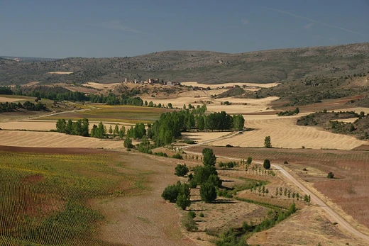
Sahel
Transition zone between Sahara and Sudanian savannas.

The Sahel is a biogeographical region in Africa, serving as the transition zone between the humid Sudanian savannas to the south and the dry Sahara desert to the north. It stretches across the southernmost latitudes of North Africa from the Atlantic Ocean to the Red Sea, with a hot semi-arid climate. The region is significant for its rapid population growth, environmental challenges, and geopolitical instability, which have led to it being called the Coup Belt.
- Population (2018)
- Approximately 80 million
- Climate
- Hot semi-arid (Köppen BSh)
- Annual rainfall range
- 100–1,000 mm
Lore & Background
Environmental issues such as desertification, over-farming, over-grazing, and soil erosion threaten the region, leading to initiatives like the Woodless Construction project and the Great Green Wall.
Reader's Guide
The Sahel is significant as both an ecoregion and a geopolitical space shaped by internal instability and external strategic competition. Its hot semi-arid climate and low, irregular rainfall make it prone to droughts, which have caused frequent food and water shortages, particularly in the western Sahel. Since the 2010s, the region has experienced numerous coups, insurgencies, terrorist incidents, and foreign interventions, earning it the name Coup Belt. The region's environmental challenges, including soil loss and dust storms, are exacerbated by unsustainable human practices. Efforts to combat desertification, such as the Great Green Wall reforestation initiative, highlight the ongoing struggle to balance human needs with ecological sustainability. The Sahel's legacy is one of resilience amid climatic and political adversity, with its acacia savannas and seasonal wetlands supporting migratory birds and a fragile biodiversity.
Did You Know?
- The term 'Sahel' comes from the Arabic word 'sāḥil', meaning 'coast' or 'shore', referring figuratively to the southern edge of the Sahara.
- The hottest temperature recorded in Sudan was 49.6 °C in Dongola on 25 June.
Frequently Asked Questions
What is the Sahel?
The Sahel is a biogeographical belt in Africa that acts as a transitional corridor between the wetter Sudanian savanna lands to its south and the arid Sahara to its north. It spans the southernmost stretch of North Africa, running from the Atlantic coast all the way to the Red Sea.
What kind of climate does the Sahel have?
The Sahel is classified as a hot semi-arid zone under the Köppen system (BSh), receiving anywhere from 100 to 1,000 mm of rain per year. This wide rainfall range reflects its position as a buffer between two very different ecosystems.
Why is the Sahel sometimes called the 'Coup Belt'?
The name reflects a pattern of repeated military takeovers and political upheaval across the countries that make up the region. Ongoing environmental stress, fast population growth, and broader geopolitical tensions have compounded the instability.
More in Deserts And Drylands 1-24
Elsewhere in the Deserts And Drylands universe
Spotted an error? Know more?
This is a living reference — every entry is fact-audited, and reader corrections feed straight into our audit queue. Suggest an edit · See this site's audit record