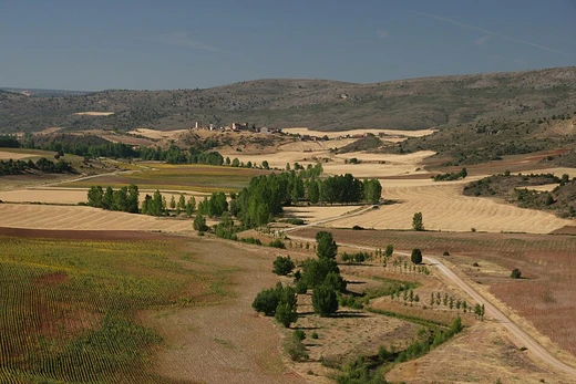
Syrian Desert
A vast West Asian desert, home to ancient trade routes and modern conflicts.

The desert is historically significant as the homeland of nomadic Bedouin and Aramean tribes, the site of ancient trading centers like Palmyra, and a strategic region in modern conflicts.
- area
- 500,000 square kilometers (200,000 square miles)
- location
- West Asia (northern Saudi Arabia, eastern Jordan, southern Syria, western Iraq)
- percentage_of_Jordan
- 85%
- percentage_of_Syria
- 55%
- notable_ancient_settlement
- Palmyra
Verified Timeline
Lore & Background
The Syrian Desert was historically inhabited by nomadic Arabs (Bedouins) and nomadic Aramean tribes, with many tribes still remaining in the region.
Reader's Guide
The Syrian Desert's significance spans millennia, from its role as a corridor for ancient trade and nomadic cultures to its strategic importance in modern warfare. Ecologically, the desert is threatened by drought, over-grazing, and hunting, leading to the local extinction of larger mammals such as the Asiatic cheetah and ostrich, though rehabilitation projects have shown success in restoring degraded land.
Did You Know?
- The Syrian Desert covers about 500,000 square kilometers of West Asia.
- It accounts for about 85% of the land area of Jordan and 55% of Syria.
- Safaitic inscriptions, proto-Arabic texts written by literate Bedouin, are found throughout the desert, dating roughly from the first century BC to the fourth century AD.
- Palmyra, a key ancient trading center, was first mentioned in the second millennium BC.
- During the Ottoman Empire's Armenian genocide, large numbers of victims were deported across the Euphrates into the desert to die.
Geography & Scale
The Gobi spans a vast territory across southern Mongolia and northern China, measuring roughly 1,600 kilometres from southwest to northeast and 800 kilometres from north to south, encompassing approximately 1,295,000 square kilometres. This makes it the sixth-largest desert on Earth. Its western edge begins near the Pamir foothills, while its eastern reach extends to the Greater Khingan Mountains on the Manchurian border. To the north, the Altay, Sayan, and Yablonoi ranges form its boundary; to the south, the Kunlun, Altyn-Tagh, and Qilian ranges mark the northern rim of the Tibetan Plateau. Despite the common image of rolling sand dunes, much of the Gobi is actually exposed bare rock rather than sand. The name itself reflects this: the Mongolian word Gov' simply means 'dryland,' and the borrowed Chinese term gēbì specifically denotes rocky, semi-arid terrain rather than true sandy deserts. Some geographers and ecologists prefer to carve out the western Tarim basin and the Lop Nor and Hami desert basins as a separate entity, the Taklamakan Desert, leaving the broader Gobi region slightly narrower in definition.
Climate of Extremes
Far from the scorching heat one might associate with deserts, the Gobi is fundamentally a cold environment. Situated on a plateau between roughly 910 and 1,520 metres above sea level and positioned well to the north, it regularly experiences frost and even snowfall on its dunes. Annual rainfall averages only about 194 millimetres, with most of that moisture arriving during the summer months. In winter, the powerful Siberian anticyclone dominates, driving icy dust and snowstorms from the Siberian Steppes across the landscape. Temperature swings are dramatic: the Gobi can plunge to −40 °C in winter yet climb to 45 °C in summer, and shifts of as much as 35 °C within a single 24-hour period are not unusual. Recorded extremes include −32.8 °C in southern Mongolia and 37 °C in Alxa, Inner Mongolia, during July. The northern reaches, locked in by persistent Siberian-Mongolian high-pressure cells, are so cold and arid that they support very little vegetation, while the southern and central zones benefit from occasional southeast monsoon moisture that allows variable plant growth.
Fossil Treasures & Living Ecology
The Gobi has proven to be one of the most extraordinary paleontological sites on the planet. In 1923, researchers uncovered twenty-six dinosaur eggs, each averaging about 23 centimetres in length, marking the first such discovery anywhere in the world. The Nemegt Basin in northwestern Mongolia continues to yield remarkable finds, including early mammal fossils, additional dinosaur egg clutches, and prehistoric stone tools dating back roughly 100,000 years. Beyond its deep past, the desert sustains a surprising array of wildlife. Endemic species such as the wild Bactrian camel, Mongolian wild ass, black-tailed gazelle, marbled polecat, and sandplover call the Gobi home, while snow leopards, Gobi bears, and wolves make occasional forays into the region. Lizards are particularly well represented, with around thirty species found along the southern Mongolian border. The dominant plant life consists of drought-tolerant shrubs like gray sparrow's saltwort and gray sagebrush, alongside low grasses such as needle grass and bridlegrass, though livestock grazing has steadily reduced their coverage over time.
Desertification & the Fight to Halt It
The Gobi is not a static landscape; its boundaries are in constant flux, and the desert is actively expanding. The southern edge pressing into China is the most alarming, with roughly 3,600 square kilometres of grassland lost each year. Between 1996 and 2016, dust storms grew noticeably more frequent, inflicting further damage on Chinese agricultural output. The drivers are largely human: deforestation, overgrazing, and the depletion of water resources, compounded by broader climate change. In Mongolia, nomadic herders raising goats for cashmere wool have degraded grasslands, while off-road vehicles and livestock trampling compound the problem, particularly in the eastern Gobi where slightly heavier rainfall once sustained more vegetation. In response, China launched the Three-North Shelter Forest Program, often called the Green Great Wall, in 1978. This ambitious tree-planting initiative, scheduled to run through 2050, aims to reverse desertification by establishing aspen and other fast-growing species across 36.5 million hectares spanning 551 counties in twelve northern provinces. In some areas, these efforts have already slowed or even reversed the advance of the desert.
Frequently Asked Questions
Who is Syrian Desert?
The Syrian Desert is a sprawling arid expanse of roughly 500,000 square kilometers stretching across northern Saudi Arabia, eastern Jordan, southern Syria, and western Iraq. It goes by several other names, including the Badiya, the Jordanian steppe, and the North Arabian desert.
What are Syrian Desert's powers/role?
The desert has functioned as a natural corridor for ancient commerce, most notably sustaining the trading city of Palmyra at its heart. It has also been the ancestral range of nomadic Bedouin and Aramean peoples for thousands of years.
How does Syrian Desert's story end?
There is no fixed finale; the region remains a flashpoint in modern military and political conflicts across Syria and Iraq. Its landscape continues to evolve under ongoing climate stress and shifting human settlement patterns.
Why is Syrian Desert important?
It accounts for about 85% of Jordan's total land area and 55% of Syria's, making it indispensable to both nations' water, grazing, and strategic planning. Its position as a bridge between the Mediterranean world and the Arabian interior has shaped trade, migration, and warfare for millennia.
What is Syrian Desert's territory/domain?
The desert spans four countries and covers approximately 200,000 square miles of West Asia. Its highest elevation is Khawr um Wual in Saudi Arabia, which rises just above 1,000 meters.
More in Deserts And Drylands 1-24
Elsewhere in the Deserts And Drylands universe
Spotted an error? Know more?
This is a living reference — every entry is fact-audited, and reader corrections feed straight into our audit queue. Suggest an edit · See this site's audit record